
GIS and Mapping
Our team utilizes the latest technology for creating state-of-the-art maps, planning documents, and design tools with Geographical Information Systems (GIS) asset data. Distribution systems, collection systems, meters, and other critical facilities can be brought into GIS using our GPS data collectors combined with field survey equipment and the latest ESRI software tools. Our mapping can be the foundation of new asset management programs and related capital improvement programs based on related condition assessments and ranking to establish priority projects.
MC Engineering has worked to formulate a standard mapping procedure that is catered to small-to-medium-sized utilities. Our approach streamlines required software costs and limits the complexity of workflows while providing user-friendly data interfaces. Our common GIS mapping deliverables include the following;
- Online asset database that can be accessed and edited on any mobile device with different levels of permissions
- Offline data access solutions for remote areas
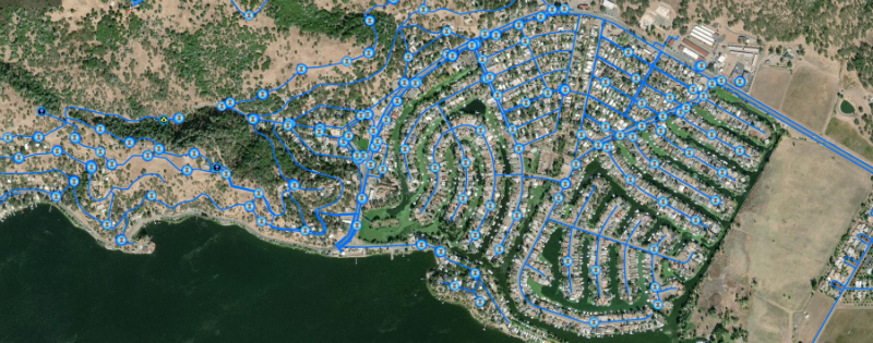
- District record drawing organization (shown adjacent)
- High-resolution drone photogrammetry of existing assets
- Workflow implementation and field staff data collection training
- Leak detection and repair reporting systems
- Converting legacy CAD and ArcMap data to new cloud/server platforms